Date: 30/6/84 17/7/89 9/7/97
Tops and Munros
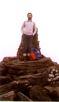
Companions: with Marjory in 84, Soren Rossner in 89 and Iain in 97
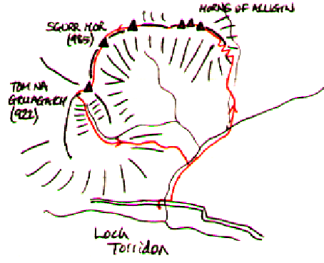
- Sgurr Mor (M) 985m
- Tom na Gruagaich (M)
922m
Distance: 12km
Climbing: 1200m
Time: 5-6 hours
Weather: I'ver never yet seen the view clearly! Low cloud or haze!
Munro Tally: M52-53, T82-83
A superb mountain! I have climbed it 3 times, all by the same route, but with different companions.
Starting from the car park on the Diabaig road, a good path leads up through the woods into Coire Mhic Nobuil. After about a mile, the path splits, and youn continue up the left hand branch into the gap between Beinn Alligin and Beinn Dearg (which at 914m deserves to be a Munro, but isn't quite!). Then the fun begins! A steep and rough path threads its way up the sandstone outcrops towards the Horns of Alligin. As you gain height, there are widening views back east towards Beinn Eighe, Beinn Dearg and Liathach.
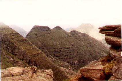
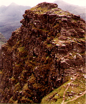
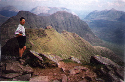
About 2 hours from the start, you find yourself on top of the first of the three "horns". Don't be tempted to bypass them by the wee path on their south side! Each horn is slightly different; all can be crossed with a little care, and the use of hands (and occasionally knees). The drops to the north side are vertiginous. The trickiest bit is the descent from the last of the three horns to the bealach before the ascent of Sgurr Mor. From here, it is 200m uphill steeply to the summit.
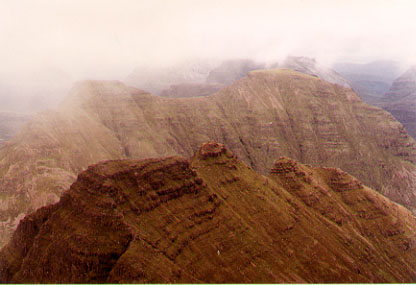
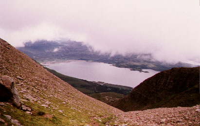
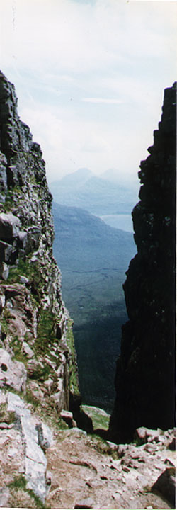
Surprisingly, the west side of Sgurr mor is simply an easy grassy slope. Don't go down it too far, though, as it is a long way from the foot of the slope to anywhere! The next amazing feature is the "great gash". It looks like a giant has hacked the mountain with an enormous axe, leaving a huge gully which runs from just below the summit down into the rock-strewn corrie of Toll a Mhadaidh Mor. Then continue down to the bealach and scramble up the rocky north ridge of Tom na Gruagaich - originally a "top" but now promoted to a 2nd Munro. Stop on its summit to admire a bird's eye view of the "horns".
From Tom na Gruagaich, the descent is down the narrow, steep and rocky Coir' na Laogh, then across peat bogs back to the car park.
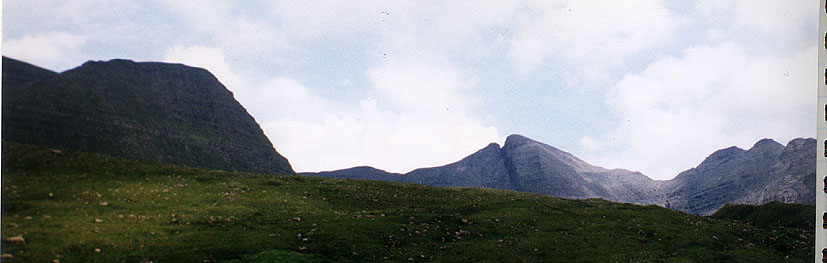
Baosbehinn, Beinn Dearg and Ben
Alligin from the beach at Gairloch