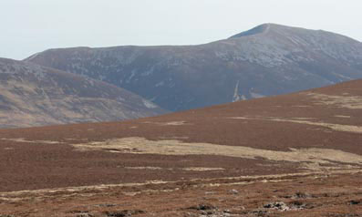
Braigh Coire Chruinn-Bhalgain from Carn Liath
Looking north from Carn Liath towards the sickle shaped cornice around the top of the south east corrie of Braigh Coire Chruinn-bhalgain.
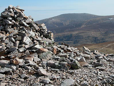
Beinn a' Ghlo, 1120m
|
Date: 04/04/81 |
Tops and Munros |
|
Companions: with Anne, and Ann & Allan Findlay, Mary & Conan Fischer |
|
|
Distance: 21 km | |
|
Climbing: 1250m | |
|
Time: 9 hours | |
|
Weather: | |
|
Munro Tally: M19-21, T28-31 | |
|
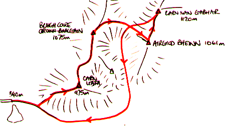
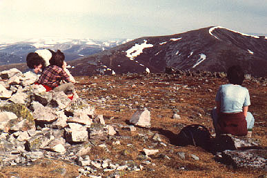
An early start from Edinburgh to Blair Atholl, where we met up with the others at a pre-arranged rendezvous. We drove up the minor road to Loch Moraig (a good start at 350m above sea level). Leaving here at 9.45am, we set off up the track, then the direct ascent of the steep west ridge of Carn Liath (a prominent landmark from the A9), reaching the summit at 12 noon. the hard work was now behind us, and we enjoyed the easy walking along the broad ridges connecting the 4 summits - Braigh Coire Chruinn-bhalgain at 13.30, Airgiod Bheinn at 14.00, and the highest top, Carn nan Gabhar at 14.30. Had some fun scrambling through the remnants of a snow cornice below the summit of Airgiod Bheinn. Afert a leisurely hour or so on the final summit, we returned to the car by droping down into the valley of Allt Coire Lagain to the south, and a long trudge around the south side of Carn Liath (3 hours return walk). Throughtout the day, the views were clear in all directions. | |
|
|
Braigh Coire Chruinn-Bhalgain from Carn Liath Looking north from Carn Liath towards the sickle shaped cornice around the top of the south east corrie of Braigh Coire Chruinn-bhalgain. | ||||
|
|
|
|
Carn Liath across Glen Tilt from Carn a'Chlamain in April 2003 |
Carn nan Gabhar from the summit of Carn a'Chlamain, April 2003 |
|
|
To see an OS 1:50000 map of : Carn Liath, click here Braigh Coire Chruinn-bhalgain, click here Carn nan Gabhar, click here
To see a road map of the area around this mountain, click here | |||
|
return to Mountains home page |
Comments or questions? david@dbethune.com |