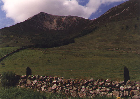
Sgorr Bhan
View of Sgorr Bhan from the farm track at the start of the walk, just leaving Ballachulish. We climbed the east ridge (the left hand side of the photo)
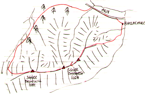
Beinn a' Bheithir, 1024m
|
Date: 12/6/1999 |
Tops and Munros |
|
Companions: with Anne |
|
|
Distance: 17km | |
|
Climbing: 1300m | |
|
Time: 7.5 hours | |
|
Weather: started bright; clouded in; drizzle, then rain later | |
|
Munro Tally: M88-89, T149-151 | |
|
We set out from Ballachulish village on a bright sunny June morning, and enjoyed the walk up out of the village and up the steep east ridge. Some scrambling needed on the higher reaches of the ridge before reaching Sgorr Bhan. From there, a most enjoyable walk along an airy ridge linking the 3 main tops, with excellent views in all directions. The sky was darkening, however, and the first spots of rain began as we reached Sgorr Dhonuill. We decided to continue down the broad west ridge, then cut off down a very steep grassy gully - too soon, there is an easier descent a bit further on. Thi sled down through the forest to a forest road, which looped around the northern flanks of the hill, evenatually leading back to Ballachulish. | |
|
|
Sgorr Bhan View of Sgorr Bhan from the farm track at the start of the walk, just leaving Ballachulish. We climbed the east ridge (the left hand side of the photo)
| ||||
|
Loch Leven and the Mamores Looking east from Sgorr Bhan, across Loch leven to the mamores, and the Ben Nevis range (already in the thickening cloud) |
| |||
|
|
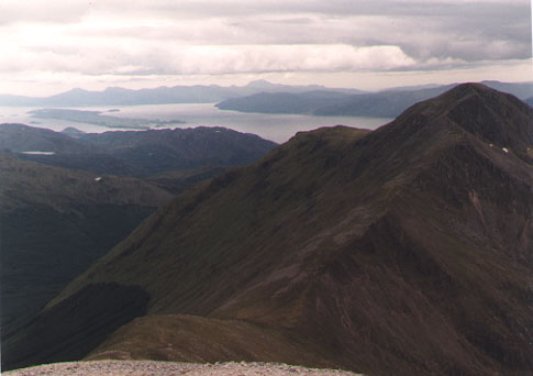
West from Sgorr Dhearg The view from Sgorr Dhearg across the bealach to Sgorr Dhonuill, with Loch Linnhe, Lismore and Mull in the background. | |||
|
|
To see an OS 1:50000 map of this mountain, click here
To see a road map of the area around this mountain, click here | |||
|
return to Mountains home page |
Comments or questions? david@dbethune.com |