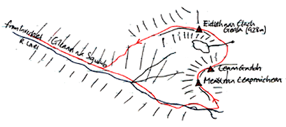
In Gleann na Sguaib
On the long walk up the glen, with Meall nan Ceapraichean at the top,
Eididh na Clach Geala
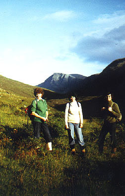
I'm not wuite sure where this photo was taken, but it was somewhere near the top. I'll need to return some day to check it out!
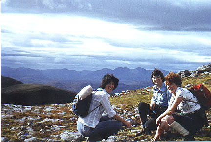
Eididh nan Clach Geala, 927m, and
Meall nan Ceapraichean, 977m
|
Date: 15/9/1979 |
Tops and Munros |
|
Companions: with Anne, Marjory and Annie Garden |
|
|
Distance: 13km | |
|
Climbing: 1200m | |
|
Time: | |
|
Weather: warm day, overcast | |
|
Munro Tally: M15,16, T23-25 | |
|
Writing this note 25 years after the climb, my memories are distinctly hazy! However, this will always be known as the "Farm or Forestry" walk. Marjory fearlessly ignored the "Farm or Forestry Only" sign at the gate at Inverlael ("I've benn here before and there is no problem," she said), and drove us up through the forest to the start of our walk. A minute oir two later, a Land Rover screeched to a halt beside us, and a tweedy gentleman jumped out. "Well then, farm or forestry?" he asked. Anne, Annie and I slunk into the background while marjory attempted to turn on the charm. All was well - he just wanted to make sure we didn't get in the way of the stalkers! This was before the days of the Hillphones website. Anyway, we had a good day on the hills, and we didn't return this way until July 2004 on our way to Seanna Bhraigh. That time, we cycled up the forest track! Eididh nan Clach Geala's only other claim to fame is that it was the last hill that John Smith MP (the greatest Prime Minister we never had) climbed before his premature death in 1994.
Eididh nan Clach geala means the "web of the white stones" . The meaning of Meall na Ceapraichean is not clear. | |
|
|
In Gleann na Sguaib On the long walk up the glen, with Meall nan Ceapraichean at the top,
| ||||
|
Eididh na Clach Geala I'm not wuite sure where this photo was taken, but it was somewhere near the top. I'll need to return some day to check it out! |
| ||||
|
| ||||
|
route plan
|
To see a road map of the area around this mountain, click here
If you want to see a 1:50000 OS map of the mountain, wait until the road map is displayed by streetmap.co.uk, then click the third "house" from the left on the zoom symbol, which will be displayed below the road map:
| |||
|
return to Mountains home page |
Comments or questions? david@dbethune.com |