Toll Creagach, 1054m

Toll Creagach stands at the NE end of Glen Affric, to the south of Loch Mullardoch, and east of Tom a'Choinich.

Date: 21/10/1983

Tops and Munros

Companions: alone

  • Toll Creagach (M) 1054m
  • West top (T) 951m

Distance: 15km

Climbing: 800m

Time: approx 5 hours

Weather: cold, clear day

Munro Tally: M46, T73-74

Anne and I set out from the car at around 12 noon on a beautiful clear and crisp day - the sun shining down from a blue sky - with baby Iain in the rucsac, 6 months old. Anne turned back with Iain after lunch at 1pm, at the point where the path to Toll Creagach branches off to the right.

I continued alone - it was in fact only my second "solo" Munro (Ben More Mull was the first one on a blazing hot summer day in 1978). I made good speed up the convex southern slopes of Toll Creagach, doing the 700m climb in just over an hour.

A huge herd of deer were grazing on the summit plateau, but ignored me as I passed then en route to the west top, the highest point of the broad west ridge. The views west into the glen Affric hills was superb. My intention was to continue up the east ridge of Tom a'Choinich, and I began the ascent. However, time was pressing on, and the rocky ridge became increasingly icy, so I turned back at around 900m, and returned down the Allt Toll Easa.

Tom a' Choinich

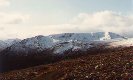
View of Tom a' Choinich from near the summit of Toll Creagach

The long south ridge of Tom a'Choinich is seen, with the sharp east ridge (on which I turned back) dropping directly from the summit.

The west top of Toll Creagach, where I saw the huge herds of deer, is the rounded hill in the middle ground.


Tom a Choinich from Toll Creagach

Toll Creagach summit view

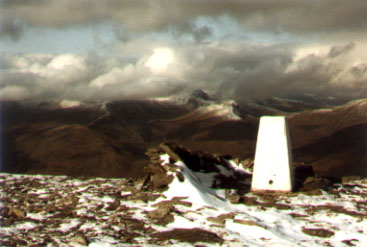
Summit of Toll Creagach

View north from Toll Creagach towards Sgurr na Lapaich across Loch Mullardoch. Weather doesn't look so good further north!

route plan >>>

To see a road map of the area around this mountain, click here

If you want to see a 1:50000 OS map of the mountain, wait until the road map is displayed by streetmap.co.uk, then click the third "house" from the left on the zoom symbol, which will be displayed below the road map:

return to Mountains home page

other mountains in this area

Comments or questions? david@dbethune.com